Delia Garza and Don Zimmerman debate density vs. sprawl

In this video, Council Member Delia Garza argues that downtown density is better for congestion than suburban sprawl, and Council Member Don Zimmerman argues the opposite. I call the argument for Council Member Garza. Here’s why:

Downtown, destinations are closer, reducing travel distance

CM Zimmerman is right that one reason suburban development causes more congestion than downtown development is that suburban residents tend to drive into downtown. Austin is a downtown-centered city. More people from the suburbs come into downtown for work, business, and entertainment than vice-versa. Placing them near these destinations reduces travel distance.

But even if downtown residents stay downtown and people on the fringes stay on the fringes, the dense development pattern downtown results in less distance spent on the roads. I spent the last weekend up on the edge of Austin, in CM Zimmerman’s district. When I stay at home downtown, there are dozens, maybe hundreds of restaurants within two miles of where I live. When I stay in District 6, traveling 10 miles for a simple night out seems normal and 2.5 miles is super close. This isn’t only about coming into downtown; even staying within the suburbs, trips are longer.

Downtown, destinations are closer, allowing more people to walk, bike, and bus

Reducing average trip distance from 20 miles to 10 miles halves the distance that somebody needs to drive. But reducing it from 10 miles to 5 miles doesn’t just halve the distance; it makes it possible for many people to bike instead of drive, using less space on the road. Reducing trips from 5 miles to 1 mile allows even more to bike and some to walk, using even less space. Bus trips are manageable where they’re short and well-served by transit. Downtown, people can choose to do without a car altogether, using very little transportation infrastructure; in the suburbs, this is practically impossible. Even for those who continue to drive cars downtown, some trips can be made on bike, on foot, or on the bus.

Downtown, uses are mixed, reducing travel distance

Downtown is denser: more buildings, more residents, more offices, more storefronts. But it isn’t only denser, it’s also more mixed. Whereas in some places in District 6, one would literally have to walk miles to get outside of a residential zone; in downtown, picking up the things you need is often as simple as going downstairs or around the block.

Downtown, uses are mixed, which mixes travel times

If you don’t live downtown and merely drive in and out at peak times, it’s easy to believe that streets downtown are hopelessly gridlocked. The truth is, though, that this is more of a function of people entering and exiting the area at peak hours. The Congress Ave bridge is congested northbound in the morning. South Lamar leaving downtown is congested southbound at night. But even the most congested downtown streets are often lightly traveled at other times of the day and many streets internal to downtown are almost never congested. While adding new residents in the Austonian is likely to add more people to the streets, it’s unlikely they’ll be driving into downtown at 8:30 on weekday mornings or out of it at 5. Instead, they may use their cars for errands or entertainment at times of light traffic.

This argument was framed as dowtown vs. fringe development but those aren’t the only two options

In this discussion, CM Garza and CM Zimmerman were only comparing dense downtown development to greenfield development on the fringes of the city. But those aren’t the only options. Moderately dense central city infill development poses many of the same benefits that high density downtown development does.

If you plan for everyone to drive cars, they will

On June 18, City Council took its first look at an ordinance to make it easier to build granny flats, also known as ADUs or backhouses. A granny flat is a small home on the same lot as a single-family home. They have traditionally been used to keep multi-generational families together or as an affordable option for rental housing. Very few new ones have been built in Austin lately, in part because rules make it hard. But this column isn’t about granny flats. It’s about one comment Council Member Leslie Pool made, about the requirement that each new granny flat be paired with an off-street parking space:

I want to acknowledge that while we’re moving in other transit-oriented directions, which I support, the reality is that people in Austin still drive cars, which is why we have the requirement for at least one [off-street] spot for a car to park.

In the past, CM Pool has showed vision toward what she calls “other transit-oriented directions” by signing AURA’s pledge to make a transit-oriented Austin. So I’d like to challenge her and any others thinking along these lines to think bigger about how they as Councilmembers can shape our city.

Off-Street Parking Doesn’t Just Reflect Our Driving Reality, it Drives Our Reality

Not every new household in Austin must bring or buy a car. I get around without a car and it’s getting easier all the time. But many people will weigh whether to own a car and decide that, as things stand, they’d be better off with one. Some of the people who decide to own a car are actually close to choosing not to have one, but are ultimately swayed by the particulars of their situation.

Our parking requirements are one of the prime reasons driving the decision to own a car:

  • Some potential ADUs in older, central neighborhoods, won’t get built because a legal parking space can’t fit on the lot or the homeowner doesn’t want to pave  their little paradise to provide a parking space.  Potential residents who would’ve chosen to live in an affordable, small, central home are forced to live further on the periphery and drive in.
  • Instead of some ADUs being built with a nice garden and no car parking, and others with a small or non-existent garden but a parking space, all will have the parking space. Deprived of the potential benefits of doing without parking, residents may as well make use of the space.

Requiring parking drives the reality of people choosing to own cars. It’s important for policymakers to not just react to life as it is now, but to be move us towards a future where people have the practical freedom to live with whatever transportation mode they choose.

How it works downtown

The city council ended parking requirements downtown a few years ago. The result has not been a parkingpocalypse of car-drivers unable to move downtown because they can’t find parking. Most new projects that have gotten built since then have included parking. This shouldn’t be surprising: downtown is mostly a high-end market and people who can afford to spend a lot of money on housing can afford cars as well. New apartment and condo complexes like Fifth and West, the Seven, or the Bowie include parking as an amenity.

But some projects are getting built with less or no parking. A new office building on Guadalupe was built completely without parking to lower rents; it advertises availability at a garage a couple blocks over. The JW Marriott hotel was built with limited parking. Some employees take public transit in; others park at a leased parking lot a few blocks away. Conference guests are encouraged to take public transit or use spaces at the convention center garage. The Aloft hotel is going to be built using a valet-only model that shifts cars to existing underutilized garages. There’s even rumors of new apartments planned for downtown without parking for a much lower price point than typical downtown living. Even though downtown is the most accessible place to live in the city without a car, the transition has been slow and gentle.

From here to there

If Council Members fear the consequences of allowing ADUS without parking, there are half-measures they could take that would get most of the benefit. One example would be to allow no-parking ADUs only near high-frequency bus lines that can support carless mobility. This would let the city continue to dip its toes into accommodating folks like me who get around without a car, while maintaining the vast majority of the city for guaranteed parking.

Other Policies

ADU parking requirements are really only the tip of the iceberg when it comes to how policy makes it impractical for most people to live in Austin without a car. Off the top of my head, some other ideas:

  • Dedicated transit lanes.  About half of those who travel down the Drag do so in buses, packed efficiently into only 6% of the vehicles. If one street lane were allocated for buses to zoom by, like the transit priority lanes downtown, this could benefit half of the street’s users in a stroke.
  • Mixing uses. The city maintains a fairly rigid separation of residential space from commercial space. This has some advantages, but the disadvantages for people getting around without a car are obvious: they have to go further from their homes to reach convenient places to work, shop, and dine.
  • Allow more residents in transit-accessible places.  There’s a limited number of places in the city that are already convenient to live without a car: downtown, West Campus, and other inner-city neighborhoods.  Building new transit-accessible places is a time-consuming and sometimes expensive process. The simplest way to allow more people the freedom to live without a car is to allow more people to live in the places that are already transit-accessible.

Vision

The reality is, Austin can’t wait until an imagined transit-oriented future before we give more people the practical freedom to choose whether to own a car. We must forge that future for ourselves. Every day that we delay, the hole we’ve dug for ourselves gets bigger. As I write, there are construction crews building subdivisions in District 6 that will be pretty much impossible to live in without a car for decades to come. Other construction crews are spending tax dollars widening MoPac so that the residents of the new subdivisions can drive into downtown. Shouldn’t we also be building places where people who choose to live a transit-oriented life can do so without paying for parking?

Density is a tool; Access is the goal

I had the good fortune of attending a lecture by Jarrett Walker, a highly-regarded transportation consultant who has worked on, most recently, Houston’s reimagined bus network.  Walker makes the good point that ultimately, transit is in the business not just of laying X miles of rail tracks, or even moving people Z miles, but of providing people freedom to access the places they need and want to go: work, school, church, restaurants, stores, parks, etc.

[youtube=https://www.youtube.com/watch?v=swcMC1Talk0&start=660]

Access here is the stuff of life. Can I get to that job interview on time? Can I get home from work in time to see a movie? Can I meet my friends for dinner? Does this okcupid match live close enough to make dating possible? When my daughter asks to play on the traveling soccer team, can she get to practice?

The context of Walker’s talk is public transportation network design. But access is just as much an issue in land use–what buildings, parks, roads, etc get built where. Whether you’re driving, riding, walking, biking, ubering, or whatever, the basic fact is that you can reach more destinations in the same amount of time when those destinations are close together. And more destinations means more opportunities–whether that’s opportunities to work, to learn, to shop, or to meet people. This was the basic lesson I took from living my own life in different parts of Boston.

This shouldn’t be a complicated or counterintuitive concept. Even with a car, traveling from one end of Austin to another is already quite a daunting trip to make more than occasionally. The more people Austin gets, the more destinations there will be–economic, cultural, or otherwise. But the more we spread out, the less access new and old residents will have to each other and to the destinations we create. We are foreclosing options by where we build.

This isn’t to say that density is the only ingredient necessary for access. There’s plenty of ways to build density that doesn’t afford much access. You can arrange your streets so that, even though two places are near each other, the path you must take to get between them is far. You can enforce a strong separation of complementary uses (homes here, shopping there, offices over there), so that, even though there are a lot of people near you, you have to go far in order to go to work or get Indian takeout. You can place density mostly on corridors, rather than in a grid, so that people must traverse the whole length to have access. This is why you often see the same people who argue for more homes in central Austin also fighting for removing gates from streets or allowing restaurants on 45th St. The connection is about removing barriers to access.

I don’t blame anybody for watching city debates and thinking that they’re mostly about abstract concepts they don’t identify with–sidewall articulations, dwelling units per acre, floor area ratio, headways, lane allocation. These are important parts of implementation. But at the heart of the matter is whether we as a city can make room so that everybody has a chance to participate in meeting new people, building a career, finding love, getting an education, seeing great music, and whatever else we want to do. The more distance we put between ourselves, the fewer opportunities we have.

From 300 to 100,000: Making Transit Oriented Development Normal

The Burnet Road rezoning case I’ve been following (1, 2) is over. City Council voted not only to approve the apartments, but passed Greg Casar’s proposal to increase the number of allowed apartments from 225 to 300. The developer correspondingly upped his pledge to 45 rent-reduced units and committed to a certain number of those having 1, 2, and 3 bedrooms.

This is great, because 300 households will soon have the option of living in nice, new homes right along one of the city’s prime bus lines (the 3/803). But 300 might not be enough to handle the people moving here in a week, let alone a month or a year or burning off the backlog of people who already live in Austin, but want to live more central. In his state of the city, Mayor Adler set a target of 100,000 new units over 10 years. I don’t know if that’s enough! In the end, we as a city should set our goals based on vacancy rates, rents, and home prices, not arbitrary round-number targets. But we already know that we have to build a lot of new homes in central Austin. I’ll use the notional “100,000” though to mean “enough units to reach price stability.”

So, how do we get to 100,000?  No one idea is going to be enough. Brennan Griffin has kicked off the discussion with a list of things already getting built in Austin’s core: downtown, Mueller, VMU, ADUs.  I’d throw in UNO as well. But today, I’ll focus on one option to get us further: making transit-oriented development normal.

Transit Oriented Development

Transit-oriented development is just a name for homes and offices and other places designed for people to get to without cars. Of course, it should be near good transit (whether buses or trains or streetcars or whatever). It should also have fewer amenities oriented around cars, like parking spots, and instead have amenities oriented around walking, like a front door you can take onto the sidewalk without traipsing through parked cars.

Austin has three plans for TOD, centered around the Crestview, MLK, and Plaza Saltillo MetroRail stations. These TOD districts are a kind of small-batch, artisanal zoning district, crafted painstakingly over the course of years, for small groups of customers to truly love. As it says on Page 97 of the Plaza Saltillo Station Area Plan:

Planning for the TOD Districts has been a lengthy and complex process. It has involved numerous stakeholder groups, including the City, private developers, and affordable housing advocates. DMA’s recommendations are the result of careful consideration of all interested parties with an eye toward the creation of a vibrant, diverse, and affordable community.

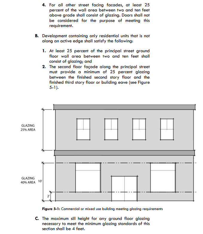
Detailed Glazing Rules
The Plaza Saltillo regulating plan has extraordinarily detailed design requirements hand-crafted by specialist consensus-builders to meet the specific needs of a relatively tiny area of the city.

However well you think these plans have accomplished their goals within their borders, they just don’t add up to much. Austin as a whole is getting less affordable, less diverse, and in many ways less vibrant. Most of Austin’s growth is in traffic-oriented subdivisions along the edge. We are a city with more than 800,000 residents, gaining more new residents than almost any city in the United States, convening stakeholder processes with dozens of people planning a couple hundred homes for years. It just doesn’t scale up.

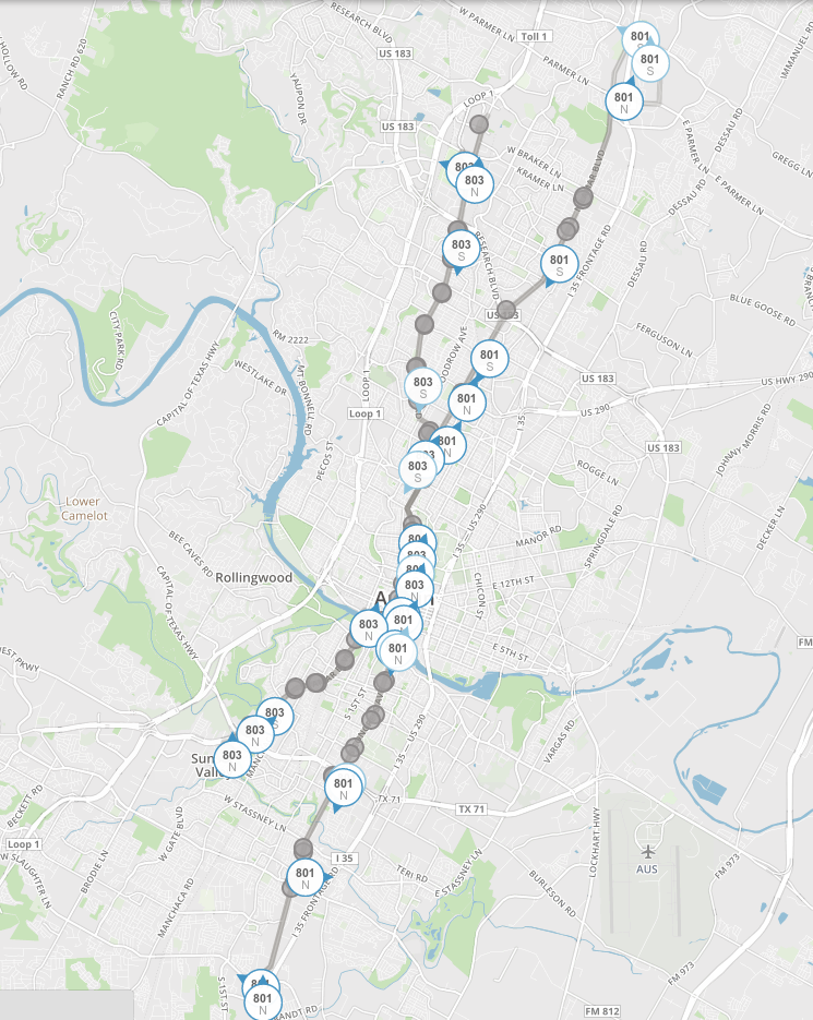
Map of 801 + 803 bus stops
Frequent bus service already covers a lot of the city. Imagine a 10-minute walk radius around each of these stops.

Meanwhile, in many areas that are pretty good for living without a car (far better than MLK station), we have to fight tooth and nail for every new transit-friendly home! Build a side house in West Campus? Not without car parking, you don’t! We need to pull some of the simplest elements for TOD out of the realm of the exotic, craft-zoned district and into the realm of the ordinary. People who want transit-oriented development shouldn’t be limited to tiny patches of the city, each with their own special rules. Ordinary home-builders should be able to follow  standard, city-wide design documents and end up with transit-friendly homes in transit-friendly places all over.

I have no issue if the city wants to keep experimenting with extensive transit-oriented regulations in small places, but in order to see real, sizable effects, we need to update the code in general to be more transit-friendly. I’m not going to get deep into the weeds, but the basic ideas aren’t complicated and could be implemented immediately: anywhere within a 10-minute walk of a good transit line is “transit-friendly.”  In a transit-friendly area, you should be allowed to build transit-friendly homes without expensive car amenities.  You should tweak our density-limiting code in these areas so that you can build more homes close to the transit stops–distance matters a lot when you’re walking to your bus stop. Perhaps also make these areas more mixed-use, whether in the same building (vertical) or on the same street (horizontal), to provide more destinations for people to walk to. We must not worry so much about making each new transit-oriented area have the perfect feature set if it means years of delays on the most important feature: existence.

Because these transit-friendly buildings will be built spread out around the city, wherever there’s decent transit, rather than clustered in a single area, they may go pretty much unremarked. They won’t fix all the problems of a city code built up for decades around the paradigm of a-chicken-in-every-pot, a-car-in-every-garage. But to build a more affordable city with more transit-friendly options we need to make “affordable” and “transit-friendly” simple, ordinary, and widespread, and iterate from there.

Planning Commission Fiddles While Austin Rents Burn

Austin’s new City Council members were elected on a platform of affordability. In a recent zoning case, the majority have turned to the straightforward, economically literate explanation for why our central city prices are burning so hot: too many people want to live in not enough homes (1 2). But Planning Commission, made up of citizens appointed by the previous Council, hasn’t gotten the message.
Continue reading

3 types of affordable housing in Burnet / Rockwood debate

I’ve previously discussed the difference between two kinds of affordable housing: the mandatory kind (means-tested, reduced rent programs) and the market kind (housing that is inexpensive on the open market). In the Burnet / Rockwood case (history: 1, 2), however, there were really three concepts of affordable housing under discussion: lowering market rents, providing selective rent reductions, and providing deeply affordable housing for the very poor.

Continue reading

Councilmembers’ approach to zoning, in their own words, part 2

Last month, City Council took up one of their first large zoning cases, a proposed apartment complex near Burnet Road. Many of them used the opportunity to expound not only on the case in question, but some of the principles behind their decision, and I duly blogged those takes. Zoning changes require 3 “readings” (i.e. 3 different votes). If there’s no disagreement, all 3 readings can happen on the same night. But in this case, there was disagreement, so they only passed the vote “on first reading,” and this last Thursday, revisited it. If you’re interested in the background and outcome of the decision, check out Liz Pagano’s take in the Austin Monitor. Me, though? I’m interested in hearing what the Council Members had to say about their approach to zoning.

District 10 Council Member Sheri Gallo

Gallo here notes that the majority of Austin rents, neighborhood associations don’t always do a good job representing them, and it’s the responsibility of City Council to look out for all residents, not just the organized ones. Readers of this blog will be familiar with both the renting and neighborhood association ideas.

Here, Gallo gives her opinion that the reason why rents have risen in Austin is an imbalance of supply and demand, and suggests more housing supply is needed to stop price increases. This, again, is familiar territory on this blog.

District 3 Council Member Pio Rentería

CM Rentería, similar to CM Gallo, believes that raising supply will stabilize prices.

District 4 Council Member Greg Casar

Casar offers a number of ideas here. First, he discusses a “filtering up” mechanism, where, if new housing doesn’t get built, old (or “vintage”) housing can become more expensive, giving as an example housing his brother lives in in Los Angeles.

Another two ideas that Casar argues for are that: 1) building housing is in and of itself, a “community benefit.” 2) There is an additional “economic integration” community benefit to having some portion of that housing be mandated Affordable Housing.  Neither of these ideas are new to council. Nevertheless, it’s interesting to hear both of them in the same speech. Frequently, the “economic integration” argument appears on the side of somebody arguing against denser zoning. In this case, though, Casar appeared to be arguing for greater density as a mechanism for making more Affordable Housing economically viable for the developer.

Mayor Steve Adler

I publish this not because Adler offered much background on his approach to zoning here, but because of the previous rarity of seeing a Council Member ask a developer to consider greater density on a site.  (Sorry, I accidentally cut the video short; the developer said yes, he would consider it.)

District 2 Council Member Delia Garza

Garza offers two items of note: 1) delays in the development process add to the costs of housing, and 2) Austin is a high-demand city, and when there isn’t enough housing supply in richer areas, this adds to gentrification pressures in poorer areas.

District 8 Council Member Ellen Troxclair

Troxclair offers a bit of a procedural take, arguing that Council’s way of using zoning as a negotiation tool encourages parties to take extremist positions. She appears to have misspoke when she said she couldn’t support MF6; she voted, as she did in the previous reading, for the higher-density MF6 and against the lower-density zoning.

The Developer

Finally, we hear from the applicant, C.J. Sackman, the developer of the project. I’m including this testimony not because his views will have lasting impact on the Council the way that Council Members’ do, but because they’re broadly representative of developers’ views.

The Rest

CM Pool (District 7), CM Kitchen (District 5), and CM Houston (District 1) emphasized that, because there was disagreement between a neighborhood association objecting to the project and the developer and because the two hadn’t fully negotiated, they wanted to pass a lower zoning category on 2nd reading only, to pressure the two sides to negotiate. CM Zimmerman (District 6) thought there had been enough testimony, and moved for the decision to be made for the higher zoning category on 3rd reading. Mayor Pro Tem Tovo (District 9) voted with Pool, Kitchen, and Houston.  In her testimony, Tovo focused on whether the developer could have provided steeper discounts on the Affordable Housing apartments, to target a poorer population.

Real-time bus data can improve effective frequencies

In February, Capital Metro expanded the reach of real-time bus data from the 801 and 803 routes to the entire fleet. There have been a few pieces about the promise of real-time data: the piece of mind of knowing your bus is actually on its way, the ability to save wait time by only heading out to your stop at the last minute, the promise of real-time data to evaluate system performance. I’d like to add one more: improving practical frequencies.

As long-time readers know, one of my pet peeves is buses that run in the same direction, but pick up at slightly different locations. Two bus routes that each run 2x / hour and run together for some length could become one combined route running 4x / hour along that length if they picked up at the same location. In Austin, this is the case for the central transit corridor from downtown to UT / West Campus along the 1/3/5/19/801/803 bus routes.

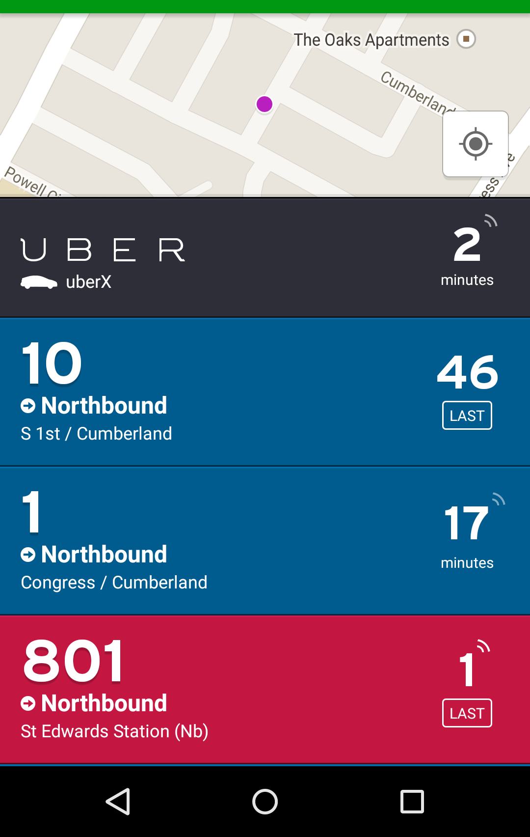
Downtown, the problem I complained about in the linked piece has been resolved; almost all north-south bus routes through downtown are now running on the Guadalupe / Lavaca transit priority lanes. However, during SXSW, as I stayed in a short-term rental in between South Congress and South 1st, I had a less extreme version of the same effect. My location was halfway between the South 1st corridor, where the #10 bus ran and the South Congress corridor, where the #1 and #801 buses ran. In the pre-real-time data days, this would have meant that I would have had to choose between waiting for the 10, waiting for the 1, or waiting for the 801, all of which pick up at different stops.

With real-time data, I could just look at my free Transit app and see which bus was approaching next:

Transit App Screenshot

During morning rush hour from my rental to downtown, there were five buses per hour on the 801, two buses per hour on the 10, and two buses per hour on the 1. Prior to real time data, that equals five buses per hour, as I would have had to choose which stop I was going to wait at and would’ve chosen the one with the most buses. With the advent of real-time data, that equaled 9 buses per hour, as I could choose which stop actually had the next arriving bus. Obviously, this only applies in some locations. But where it does, it’s a major improvement!

What Compact and Connected Means to Me

On March 23, I presented at the CNU Central Texas City Matters 20×20 panel on the subject of “Compact and Connected” and what that means to me. The format of the presentation called for a ton of pictures. This post is adapted from my presentation. Thanks to the great team at CNU for prompting me and pushing me to put this together.

To me, Compact and Connected means independence and an opportunity for personal growth. I’m rare in Austin as somebody who is eligible for a driver’s license but doesn’t have one. This is the story of how that came to be, and how much the places we live affect who we are.

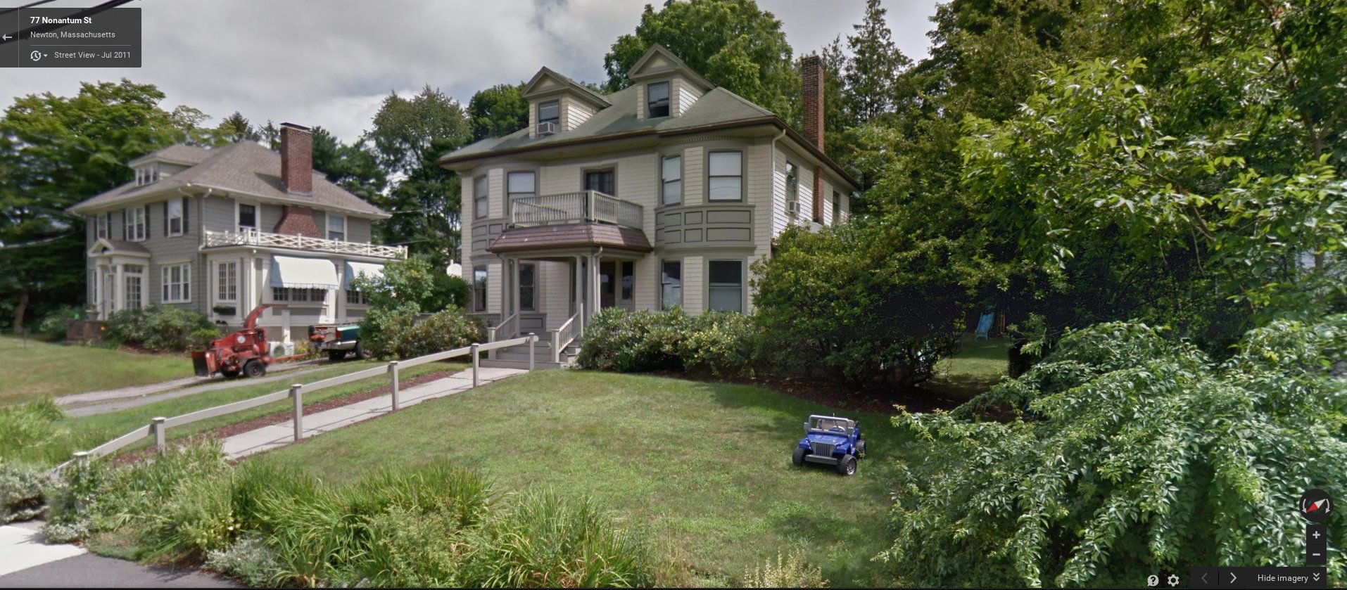
I grew up in Newton, MA, a gorgeous but expensive Western suburb of Boston. My house, an 1890 Victorian, would fly through the historic landmark commission in Austin, but was typical of the city block I lived on. The place had many of the amenities that school-aged parents wanted: good schools, large lots with green lawns (9600sf), an acclaimed public library, and easy freeway access to downtown Boston.

My childhood home
My childhood home, c/o Google Maps.

Although all of our parents had moved there for the schools, to myself and my 15-year old friends, we as children were frequently bored. The first thing we wanted to do when we were old enough was get a driver’s license. To us, a driver’s license meant freedom. Freedom to see our friends on our own schedule, to go to restaurants, to go to parks, to go into Harvard Square and listen to street musicians. Freedom to explore our world.

For me, though, it was not meant to be. About the time I’d be going for my learner’s permit, I became ill. That meant two dramatic things that made a profound impact on my life for decades to come: 1) I was unable to learn to drive, and 2) I missed too much school to graduate in four years, and took a fifth year doing an alternative learn-from-home program.

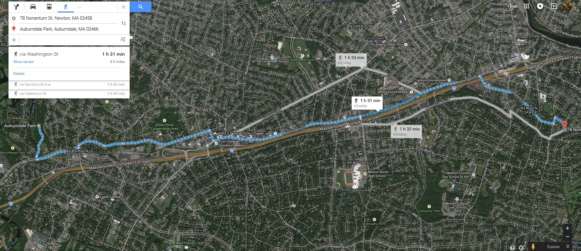
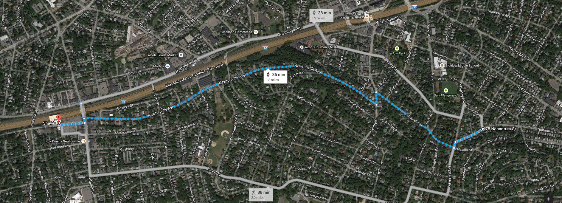
During that fifth year, I felt the sense of deep isolation that car-oriented cities create. Newton was built centuries before the automobile, but the last trolley lines had been torn out decades before I was born and the city had been remade over the decades to accommodate cars. It would take me 3 hours to walk to one of my closest friends’ house and back.

Waaay too long walk to close friend and high school classmate's house.
Waaay too long walk to close friend and high school classmate’s house.

The closest grocery store was 35 minutes there and a lot longer than that walking back carrying groceries.

35+ minute walk to conventional grocery store.

That acclaimed public library was 45 minute walk. The only commercial cluster near me didn’t offer much (pizza and a convenience store is all I remember) and closed early. Despite living in what truly was one of the most desired places in Boston, I literally couldn’t feed myself, couldn’t see old friends or make new ones, find any sort of job, or continue my education without being 100% dependent on my parents and their cars.

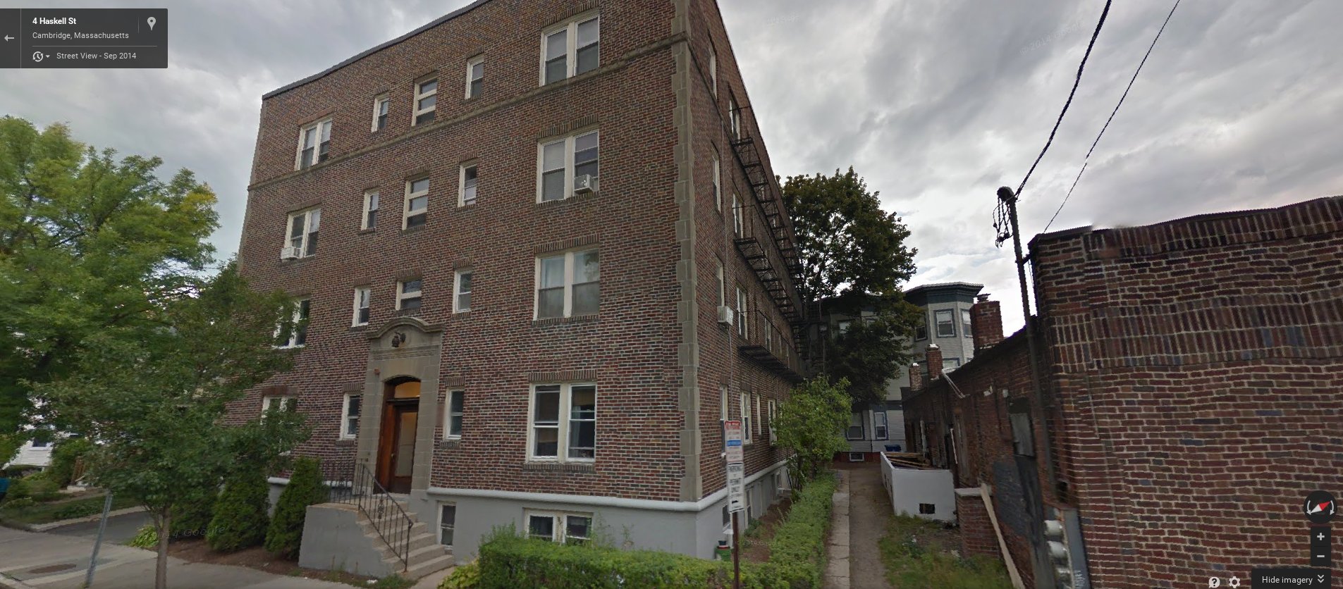
So, about two weeks after I graduated high school, I moved into the compact, connected community of North Cambridge. What do I mean by compact and connected? Compact: Instead of living in my parents’ 3,100sf home, I lived in a 500 sf studio apartment in a modest 24-unit corner complex.

The first apartment building I lived in.

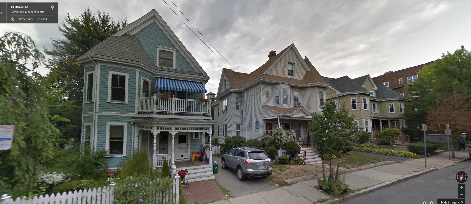
What do I mean by compact? The houses along my new street were closer together, and multiple families shared a single house.

Houses neighboring my apartment building
Multifamily houses neighboring my apartment building.

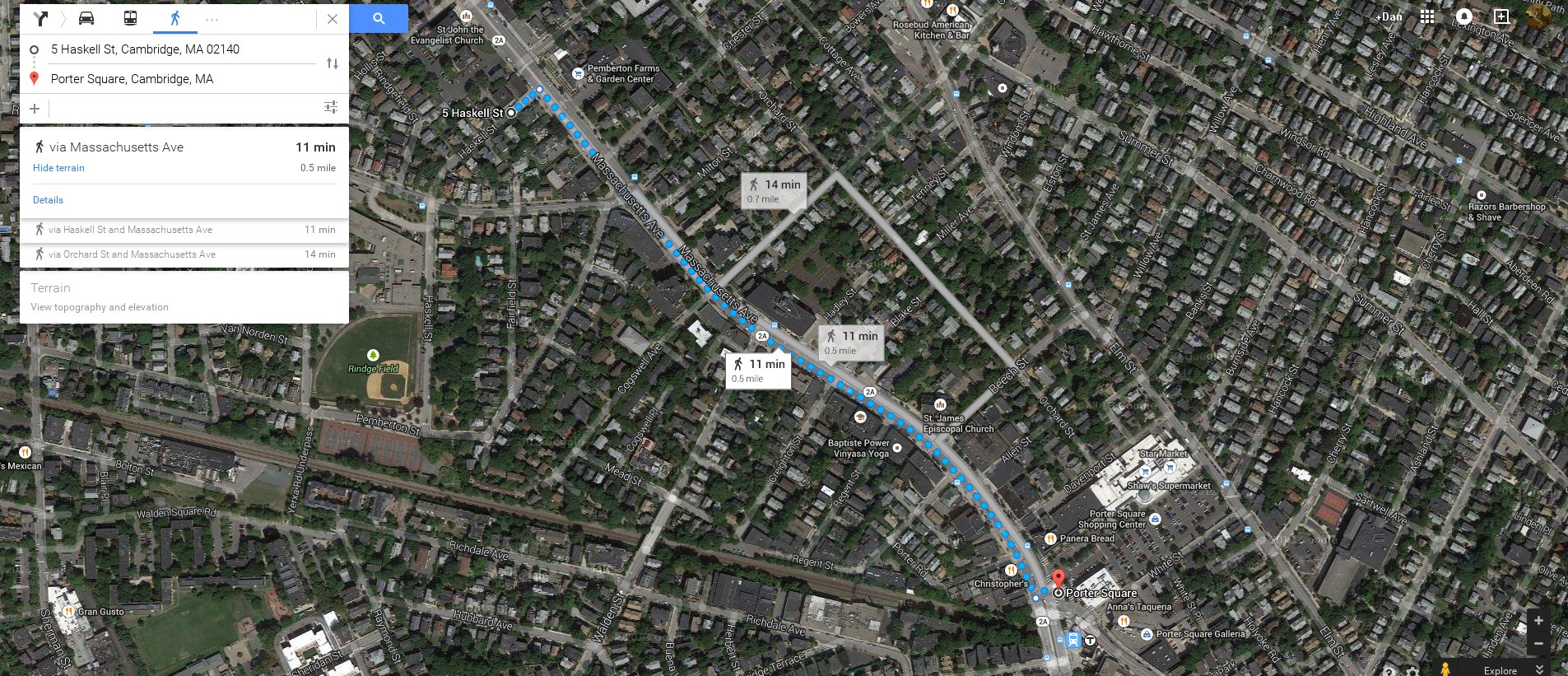
And just as the distance between people’s homes was more compact, so too were the distances between my home and the places I needed to be. There was a grocery store 10 minutes walk from me.

10 minute walk to conventional grocery store.

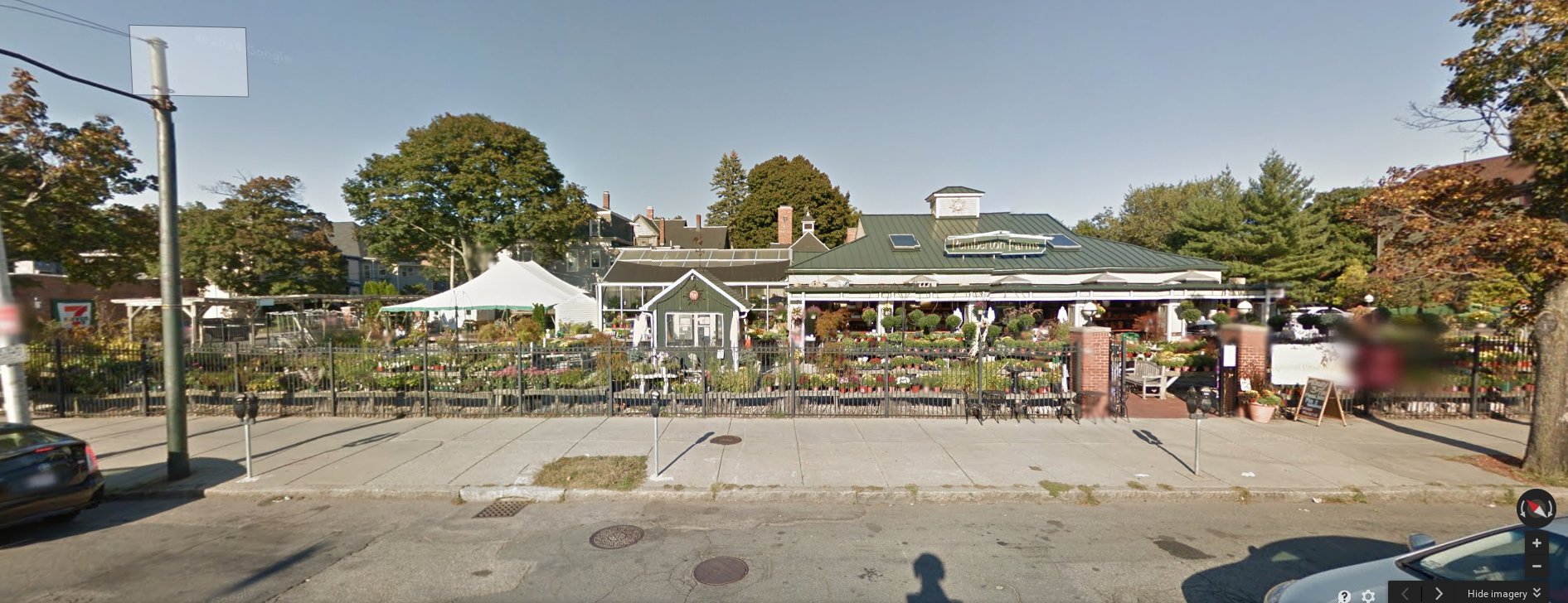
There was a smaller grocery store with high-quality produce literally across the street.

Farm and Garden Center across Massachusetts Ave from my apartment building.

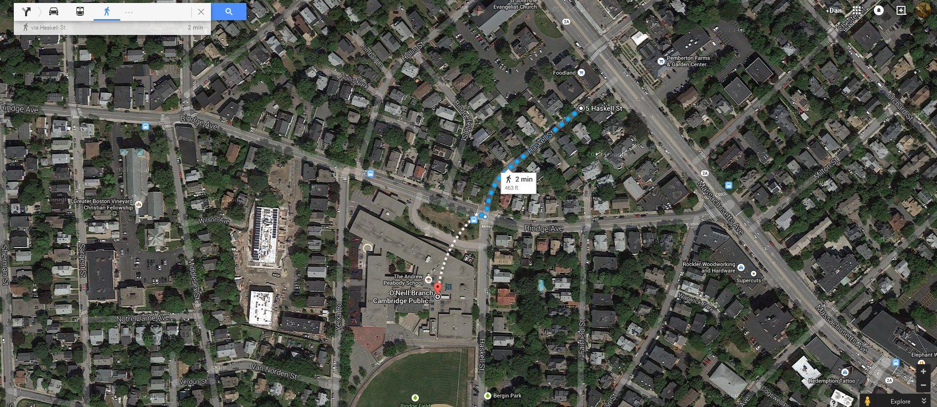
While the public library was a bit more “compact” than Newton’s, it was literally 500 feet from my home, and I would stop by sometimes multiple times in a day.

463' walk to Cambridge branch public library.
463′ walk to Cambridge branch public library.

So, for me, compact meant the independence to be able to feed myself, take care of myself, and get an education. So, you might be asking, how does this apply to everybody else?  Not everybody finds themselves in a situation where they can’t drive. For them, does it matter whether you can get somewhere in 10 minutes on foot vs. 10 minutes in a car? If you drive, you already have the independence to take care of basic needs, even car-oriented places like Newton.

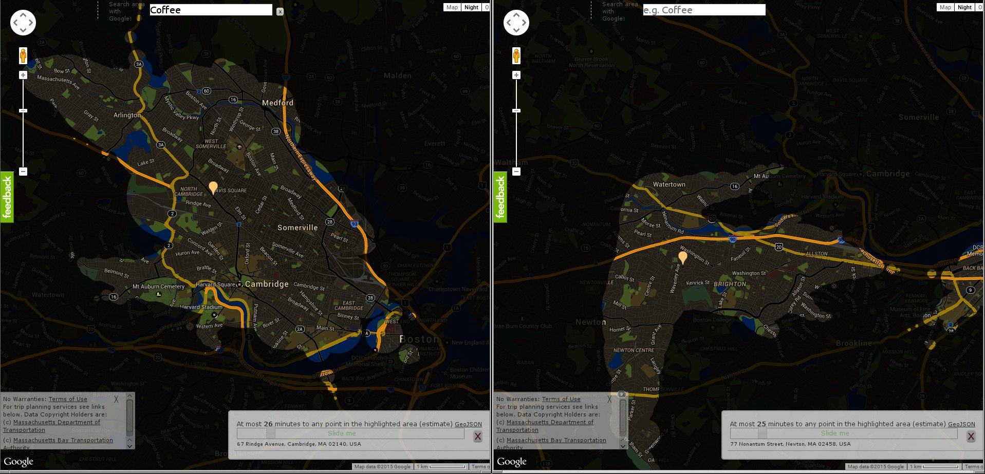
That’s where connected comes in! Newton and North Cambridge were both on public transportation routes. Here is a visual of places I could quickly reach on public transportation from my homes:

Area I could quickly travel on public transportation in Newton vs Cambridge.

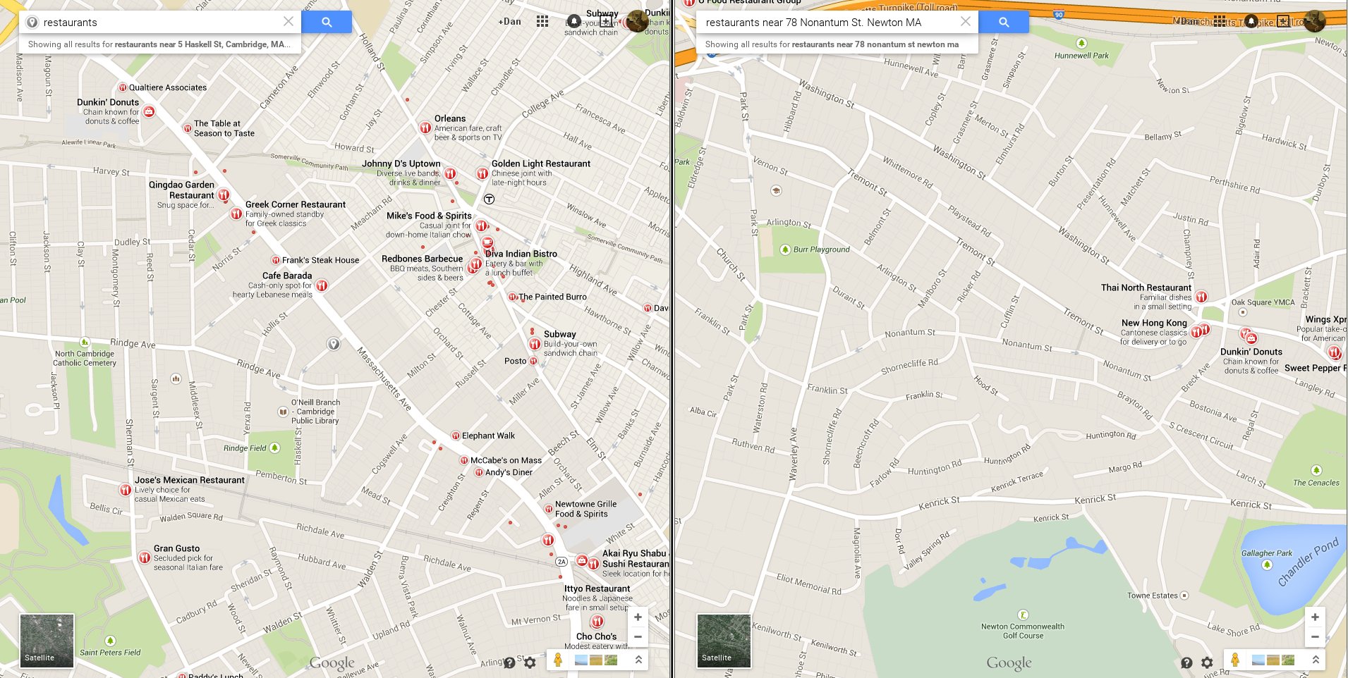
Cambridge’s density allowed for more frequent, better public transportation, that had a geographically broader reach than that in Newton. But that’s only a tiny portion of the story. Because Cambridge was built densely, with things closer together, that geographical reach translated into way more destinations. Here, for example, are the restaurants nearby each of my homes:

Restaurants nearby in Newton vs Cambridge

Note not only how many more there are in Cambridge, but the variety. By moving to Cambridge, I exposed myself to Tibetan, Bengali, and Nepalese food, to a little Japanese-oriented mall, and to specialty book stores. I got heavily involved in local political movements of all flavors, and heard dozens of languages spoken on the street. Perhaps most importantly, I was able to take night classes in Computer Science at a local college and find a starter job in the tech industry, without which I wouldn’t be employed as a computer programmer today.

I’m no longer the isolated kid I was, and I’m sure I could make a fine life for myself in the suburbs. But, for me, compact will always means independence, and connected will mean personal growth and I wouldn’t have it any other way.